Featured In Global Media


Operational Capability
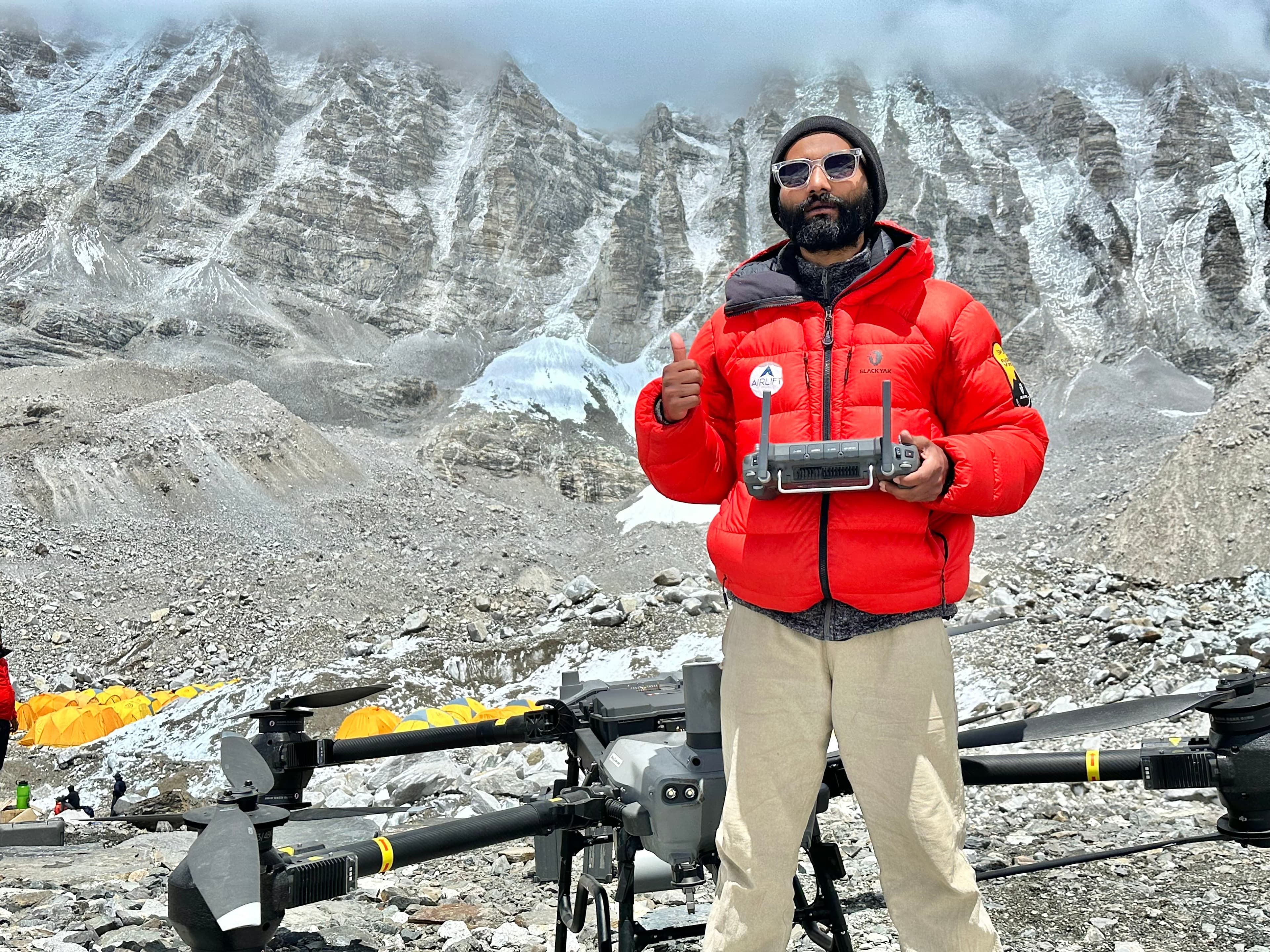
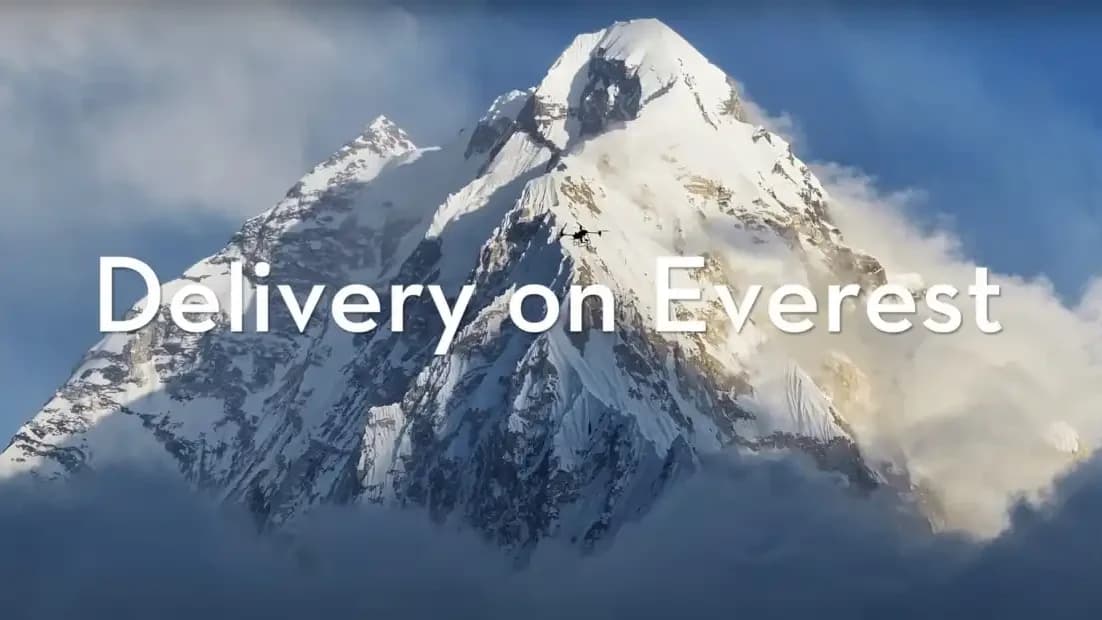
Historic World Record - World's Highest Drone Delivery
High Altitude
Everest Drone Delivery
Core Capabilities
What We Do
Autonomous Drone Logistics
End-to-end automated cargo transport with intelligent route optimization.
Heavy-Lift High-Altitude Delivery
Payload delivery at extreme elevations where conventional logistics fail.
LiDAR & Photogrammetry Mapping
Sub-centimeter terrain modeling for surveying and infrastructure planning.
3D Digital Twin Modeling
Photorealistic digital replicas of structures, terrain, and environments.
Aerial Inspection & Monitoring
Automated infrastructure assessment for power lines, bridges, and pipelines.
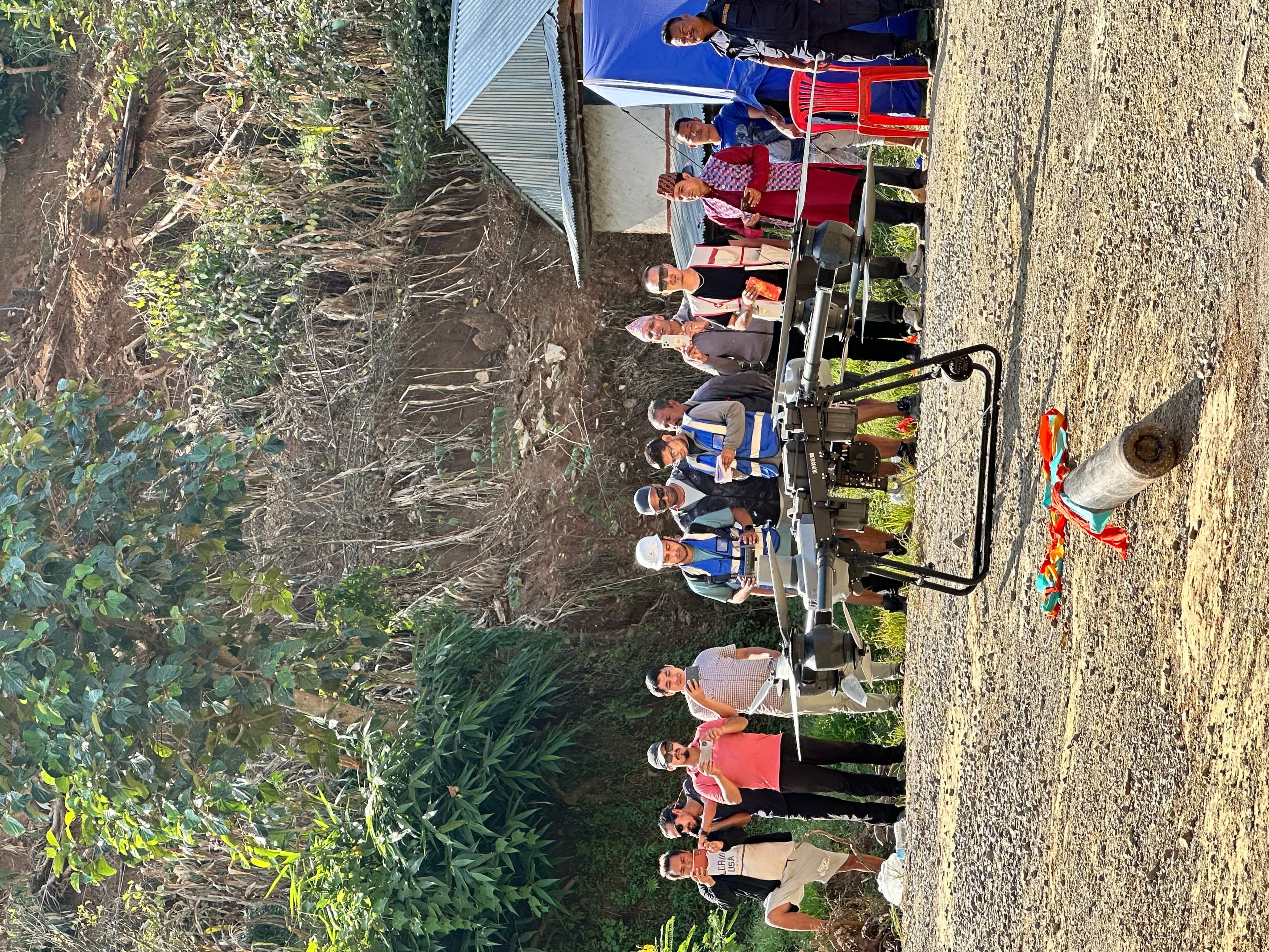
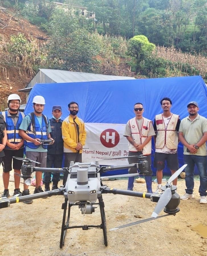
Emergency Response Deployment
Rapid aerial deployment for disaster relief, search, and rescue operations.
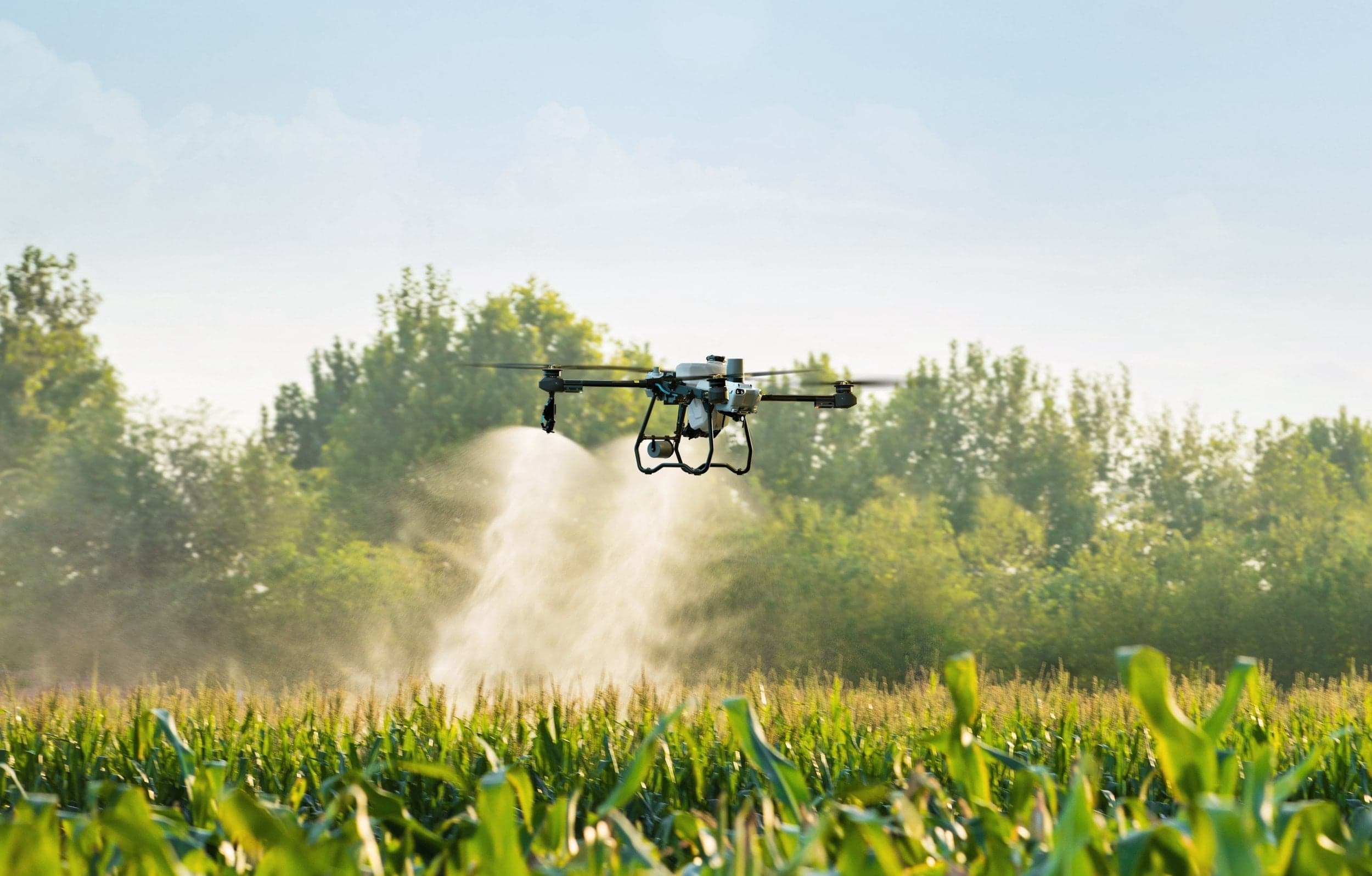
Precision Agriculture Services
Multispectral crop analysis and automated precision spraying systems.
Worlds Highest
Drone delivery
We design and operate autonomous logistics networks for mountaineering, logistics, agriculture, defense.
From the high Himalayas to dense urban centers, Airlift Ventures is redefining infrastructure. We don't just fly drones; we build the invisible highways of the future.
Airlift Verticals
Core Business

COMMERCE
Autonomous last-mile logistics. Heavy-lift capability for medical & cargo transport.

Who We Serve
Industry Sectors
Government & Public Sector
Aerial data solutions for infrastructure planning, urban development, and public service delivery.
Infrastructure & Construction
Real-time site monitoring, volumetric analysis, and progress tracking from above.
Agriculture Enterprises
Precision crop management, automated spraying, and multispectral field analysis.
Energy & Utilities
Power line inspection, solar panel surveys, and pipeline corridor monitoring.
Environmental & Conservation
Habitat mapping, wildlife tracking, and forest canopy health assessment.
Emergency & Disaster Response
Rapid situational awareness, search and rescue, and supply delivery to affected zones.
Defense & Security
Tactical surveillance, perimeter monitoring, and secure reconnaissance operations.

Take Your
Brand To
Everest
The world's highest product placement. We handle the logistics, permits, and documentation to put your product at 8,848 meters.

Articles
FIELD REPORTS AND OPERATIONAL UPDATES

Nepal became the first country in the world to deploy delivery drones on Mount Everest
Airlift Ventures successfully tested FC30 cargo drones between 5,300 and 6,000 meters altitude, transporting 15 kg of supplies from Base Camp to C1 in 10 minutes—a journey that takes climbers 6-8 hours across the dangerous Khumbu Icefall.
Innovative Drone Solutions: Airlift and Esaiyo Tackle Mount Everest's Ecological Problems
Airlift Technology and Esaiyo Inc. partnered to become the first company in the world to solve waste management challenges on Mount Everest through drone technology, transporting 40 pounds of supplies upward while returning with waste.

Airlift Ventures became Nepal's 1st in South Asia to Lead Cultural Heritage Preservation: Esaiyo and Airlift's Groundbreaking Joint Venture
Airlift Ventures and Esaiyo have partnered to digitally preserve cultural heritage sites across South Asia using advanced 3D mapping technology combined with blockchain and graph technology, starting with iconic sites like Swayambhunath Stupa and Keshar Mahal.
Trusted by Industry Leaders


We do not simply operate drones. We build aerial infrastructure ecosystems that increase efficiency, reduce operational risk, and unlock new economic opportunities.